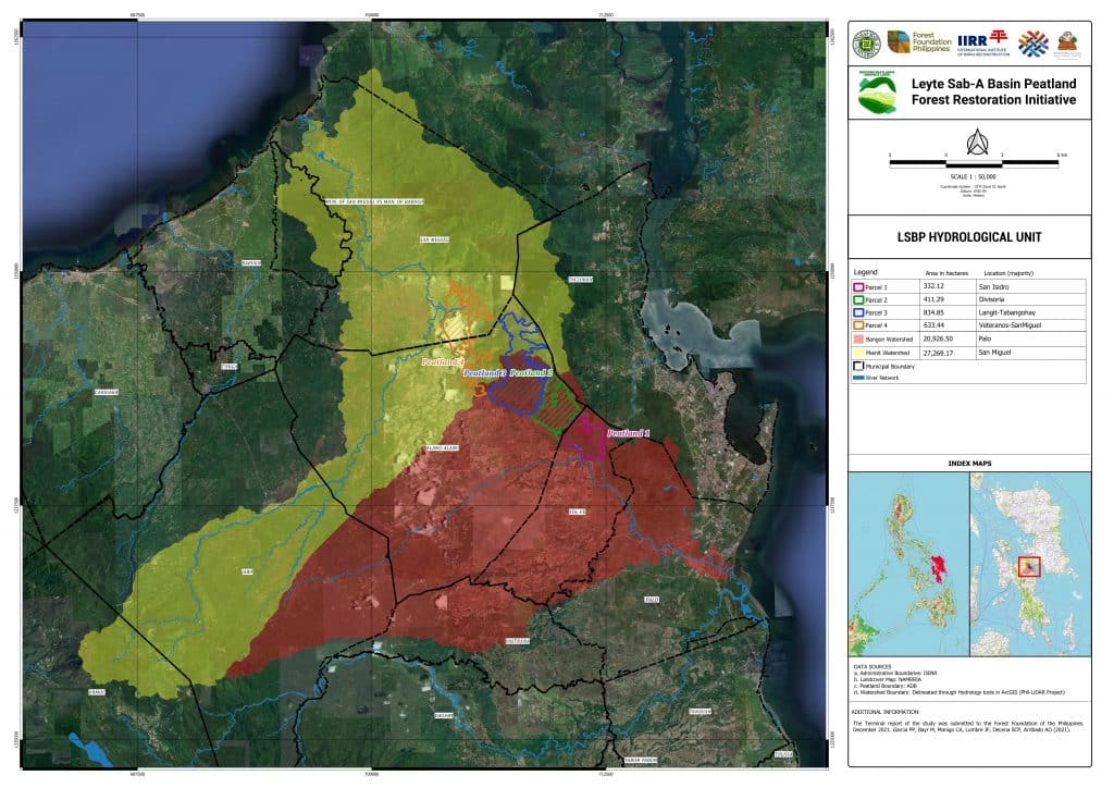
LSBP Hydrological Unit of the Leyte Sab-a Peatland Forest

Since 2018, we have been working with the International Institute of Rural Reconstruction (IIRR), our grantee, and other partners to implement the Leyte Sab-a Peatland Forest Initiative Project to protect and conserve around 1,900 hectares of the Leyte Sab-a Peat Swamp Forest.

This map features the LSBP hydrological unit of the Leyte Sab-a Peatland Forest.
Share:

Facebook
Twitter
Pinterest
LinkedIn
Download a Copy

Kindly provide the following information to proceed with the download.

By answering this form, you acknowledge that you have read, understood, and agree to our Privacy Policy.
Download a Copy

Kindly provide the following information to proceed with the download.

By answering this form, you acknowledge that you have read, understood, and agree to our Privacy Policy.

LSBP Hydrological Unit of the Leyte Sab-a Peatland Forest

Thank you for submitting the form. You can download the file using either of the buttons below. If one doesn’t work, please try the other option.

By downloading this document, you have acknowledge that you have read, understood, and agree to our Privacy Policy.