General Land Use and Vegetation Map of the Leyte Sab-a Peatland Forest

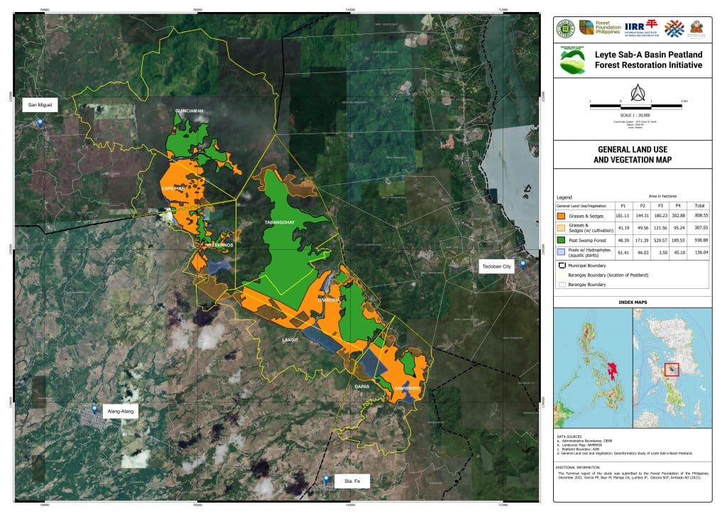
Since 2018, we have been working with the International Institute of Rural Reconstruction (IIRR), our grantee, and other partners to implement the Leyte Sab-a Peatland Forest Initiative Project to protect and conserve around 1,900 hectares of the Leyte Sab-a Peat Swamp Forest.

This document features the general land use and vegetation map of the Leyte Sab-a Peatland Forest.

Share:

Facebook
Twitter
Pinterest
LinkedIn
Download a Copy

Kindly provide the following information to proceed with the download.

By answering this form, you acknowledge that you have read, understood, and agree to our Privacy Policy.
Download a Copy

Kindly provide the following information to proceed with the download.

By answering this form, you acknowledge that you have read, understood, and agree to our Privacy Policy.